 singaporecity360°
 亨德森波浪橋(Henderson Waves Bridge)
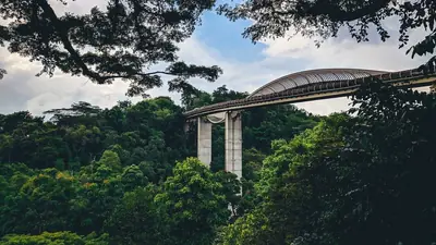
亨德森波浪橋(Henderson Waves)是南部山脊(Southern Ridges)上的一座人行橋,架在亨德森路(Henderson Road)上方,連線花柏山公園(Mount Faber Park)和直落布蘭雅山公園(Telok Blangah Hill Park)。
出發前,有 2 件事要先知道
There is no car park at the bridge and it is a steep climb from Henderson Road or from the Telok Blangah Hill car parks. Allow fifteen to twenty minutes of uphill walking.
Fully exposed with no shelter on the span — unpleasant at midday, and closed off in lightning.
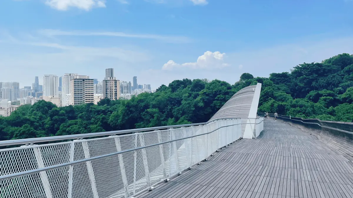
它高出路面36米,是全新加坡同類步道里最高的,橋身長274米,由一根根彎曲的木肋組成,起伏成波浪的樣子,你可以坐進這些木肋圍成的凹處裡。過橋不花錢,橋全天開放;木肋在晚上7點到約凌晨2點亮燈,這也是多數人來看景的時段——一邊俯瞰紅山(Bukit Merah),另一邊望向吉寶灣(Keppel Bay)。騎車可以,但必須下車推行過橋。
它是整條南部山脊步道中的一段,很適合接著走到花柏山公園和再往西一小段的纜車站。橋架在兩座公園之間,橋下沒有地鐵:從環線的直落布蘭雅站(Telok Blangah)要穿過直落布蘭雅山公園往上走一段,或者坐145、176、273路巴士在"Bef Telok Blangah Hts"站下車,再爬樓梯上到橋面。
這座木橋的常規賣點是夜裡的燈光,但日落前那兩個小時其實更划算:白天木質橋身和天際線都很上鏡,帶頂的木凹處能遮陰,還能避開天黑後在橋中段形成的人流瓶頸。過橋後再往前走約九分鐘進入花柏山公園,就到了Faber Point,那裡免費,視野比橋上更開闊。
雨、熱,以及應對之道
來自新加坡國家環境局(NEA)的即時讀數與預報。四天是極限——再往後, 沒有人是在預報,他們給你看的只是平均值。
西南季風
6月至9月
Short, sharp early-morning showers and occasional squall lines. Drier overall than the northeast wet phase.
The other good window. Rain tends to arrive early and clear, leaving usable afternoons. This is also when haze can occur, which is worth checking rather than assuming.
規劃你的 Henderson Waves Bridge 行程
從遊客早已聽說過的三個地標算起的直線距離。
5.2公里
西
3.7公里
西南
21公里
西南
亨德森波浪橋,各種光線下的樣子
步行可達的周邊
都在 西部(南部山脊與裕廊) —— 近得可以同一趟順路收集。

Contains information from Tourist Attractions accessed on 2026-08-01 from data.gov.sg, made available under the terms of the Singapore Open Data Licence version 1.0.