 singaporecity360°
 南部山脊(Southern Ridges)
南部山脊(Southern Ridges)是一条10公里长的步道,把新加坡西部花柏山(Mount Faber)到肯特岗(Kent Ridge)之间几座山头上的公园和高架步道串了起来。
出发前,有 4 件事要先知道
The footpath below the Therapeutic Garden at Telok Blangah Hill Park is closed until 31 March 2028 for slope works — take the NParks alternative route.
Do not enter the Forest Walk earth trail after 7pm.
A hilly ten kilometres with long unshaded stretches and very few drink stalls between HortPark and Kent Ridge. Carry water and start early — most people attempt it in the midday heat.
It is point-to-point, not a loop. Plan the bus or MRT back from wherever you finish.
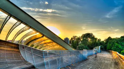
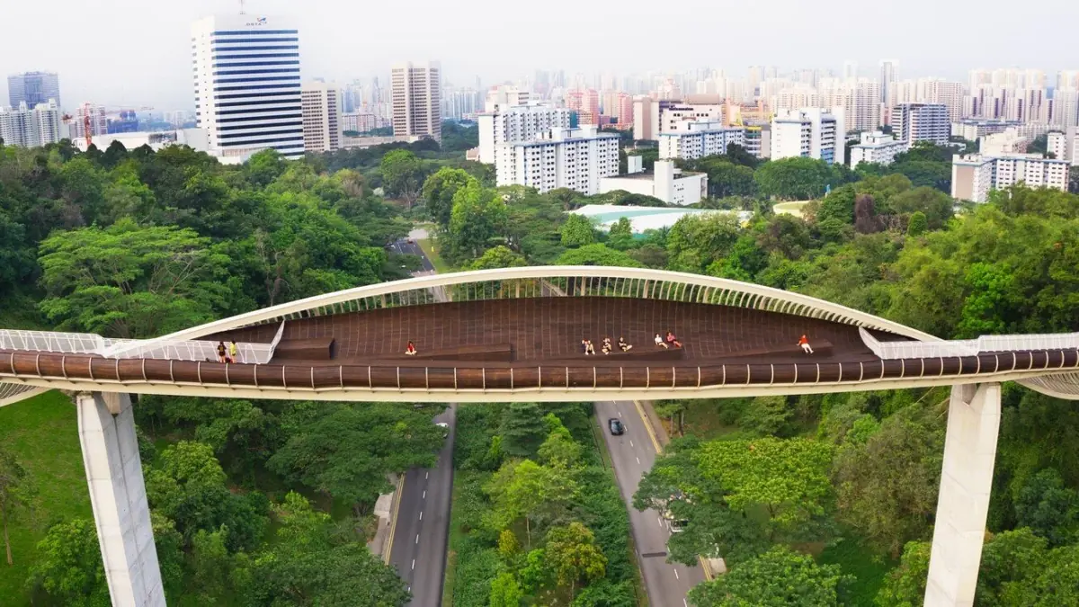
它通过一连串桥梁和栈道,连接起花柏山公园、直落布兰雅山公园(Telok Blangah Hill Park)和肯特岗公园,其中最有名的是亨德森波浪桥(Henderson Waves)——一座波浪形的木质人行桥,架在亨德森路上方36米处,是全国最高的人行桥。这些公园和桥都免费、全天开放,没什么要预订,也不用买票。多数人只走其中一段,而不是全程:亨德森波浪桥和架空的森林步道(Forest Walk)是最值得爬上去看的部分,天黑后桥的"肋骨"还会亮灯。
它就在拉柏多自然保护区和港湾(HarbourFront)的正上方,从任一处走过去都不远。坐环线到直落布兰雅(Telok Blangah)地铁站,沿公园小路走约15分钟就到亨德森波浪桥;而从港湾地铁站那头上来(走花柏山的Marang Trail)路更长、更陡——按你想在哪一头收尾来决定从哪头开始。
如果你冲的就是亨德森波浪桥,千万别从港湾(HarbourFront)出发——那条路要先爬花柏山。从直落布兰雅地铁站上来,穿过直落布兰雅山公园走到桥脚要近得多,从那儿还能继续走过森林步道、从另一头出去,不必原路折返。
雨、热,以及应对之道
来自新加坡国家环境局(NEA)的实时读数与预报。四天是极限——再往后, 没有人是在预报,他们给你看的只是平均值。
西南季风
6月至9月
Short, sharp early-morning showers and occasional squall lines. Drier overall than the northeast wet phase.
The other good window. Rain tends to arrive early and clear, leaving usable afternoons. This is also when haze can occur, which is worth checking rather than assuming.
规划你的 Southern Ridges 行程
从游客早已听说过的三个地标算起的直线距离。
4.8公里
西
3.1公里
西南
21公里
西南
南部山脊,各种光线下的样子
步行可达的周边
都在 西部(南部山脊与裕廊) —— 近得可以同一趟顺路收集。

Contains information from Tourist Attractions accessed on 2026-08-01 from data.gov.sg, made available under the terms of the Singapore Open Data Licence version 1.0.